Ngorongoro Conservation Area
The Ngorongoro Conservation Area was officially declared a UNESCO World Heritage Site in 1979. The area consists of various landscapes and includes dense mountain forests, woodlands, grasslands, lakes and swamps. Some of the most important archaeological sites in the world, such as Oldupai Gorge and Laetoli, are located in the Ngorongoro Conservation Area. Archaeologists have found evidence that the area was inhabited by hominids over 3 million years ago and could therefore be the cradle of humanity.
And then, of course, there is the Ngorongoro Crater, the largest unbroken, inactive and unfilled caldera in the world. With a diameter of about 19 km and its majestic walls rising just above 610 m, the crater floor covers an area of 260 km². More than 30,000 animals, including the rare black rhino, are at home in this unique place. Today, over 40,000 Masais live in the area, making the Ngorongoro Conservation Area one of the few places in Tanzania where human settlement is allowed within a wildlife sanctuary. The reserve borders the Serengeti National Park and you have to drive through the reserve to enter the Serengeti.
Highlights:
The crater floor is covered by various landscapes ranging from dense mountain forests and woodlands to grasslands, lakes and swamps. Water sources include the two main rivers, the Munge River to the west and the Lerai River to the east, as well as the Ngotokitok Spring, which flows into a swamp.
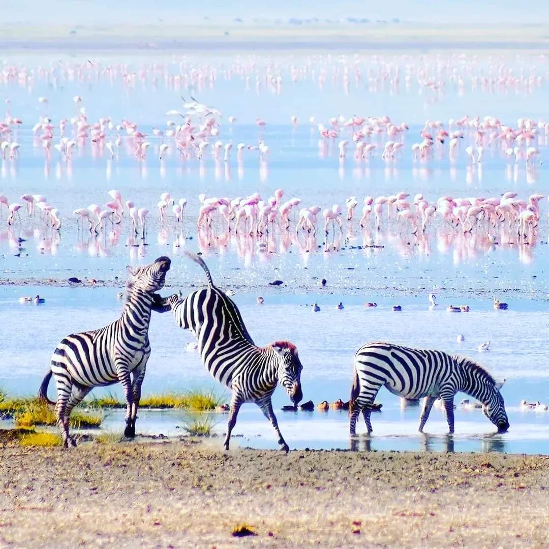
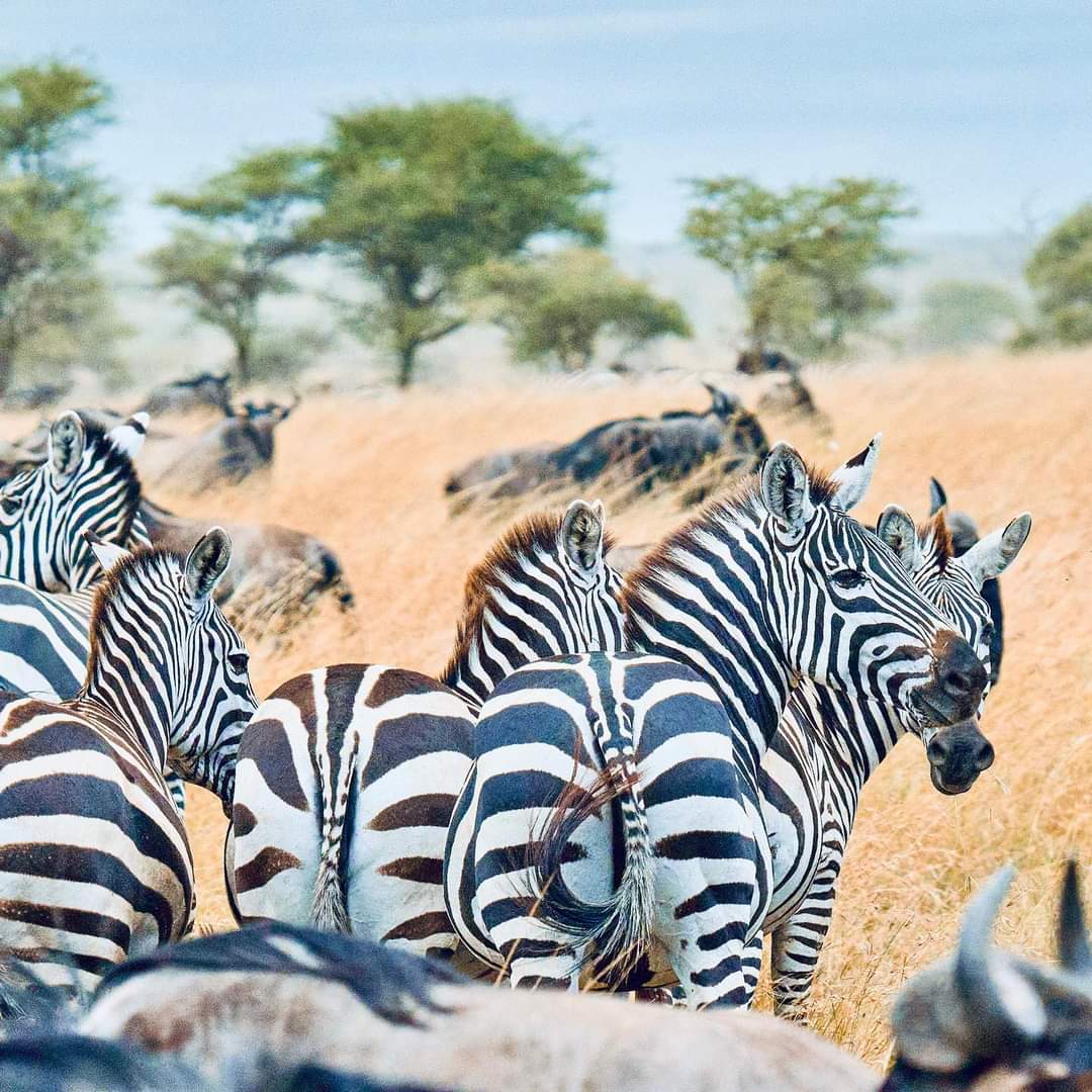
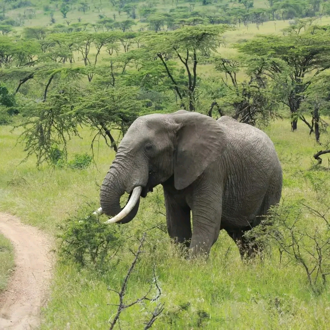
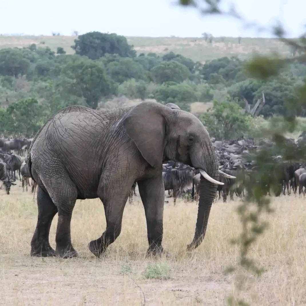
Huge herds of ungulates dominate the crater floor, with zebra, wildebeest, eland, Grant’s and Thompson’s gazelles being the most common species. But the crater is also home to the “Big Five”, and elephant, lion and buffalo are frequently spotted. Leopards are rarely seen, as they prefer to stay in the forests on the crater rim. The almost extinct black rhino can also be found in the crater and is not infrequently sighted. Serval cats, spotted hyenas and jackals are also frequently seen, while cheetahs are more difficult to spot.
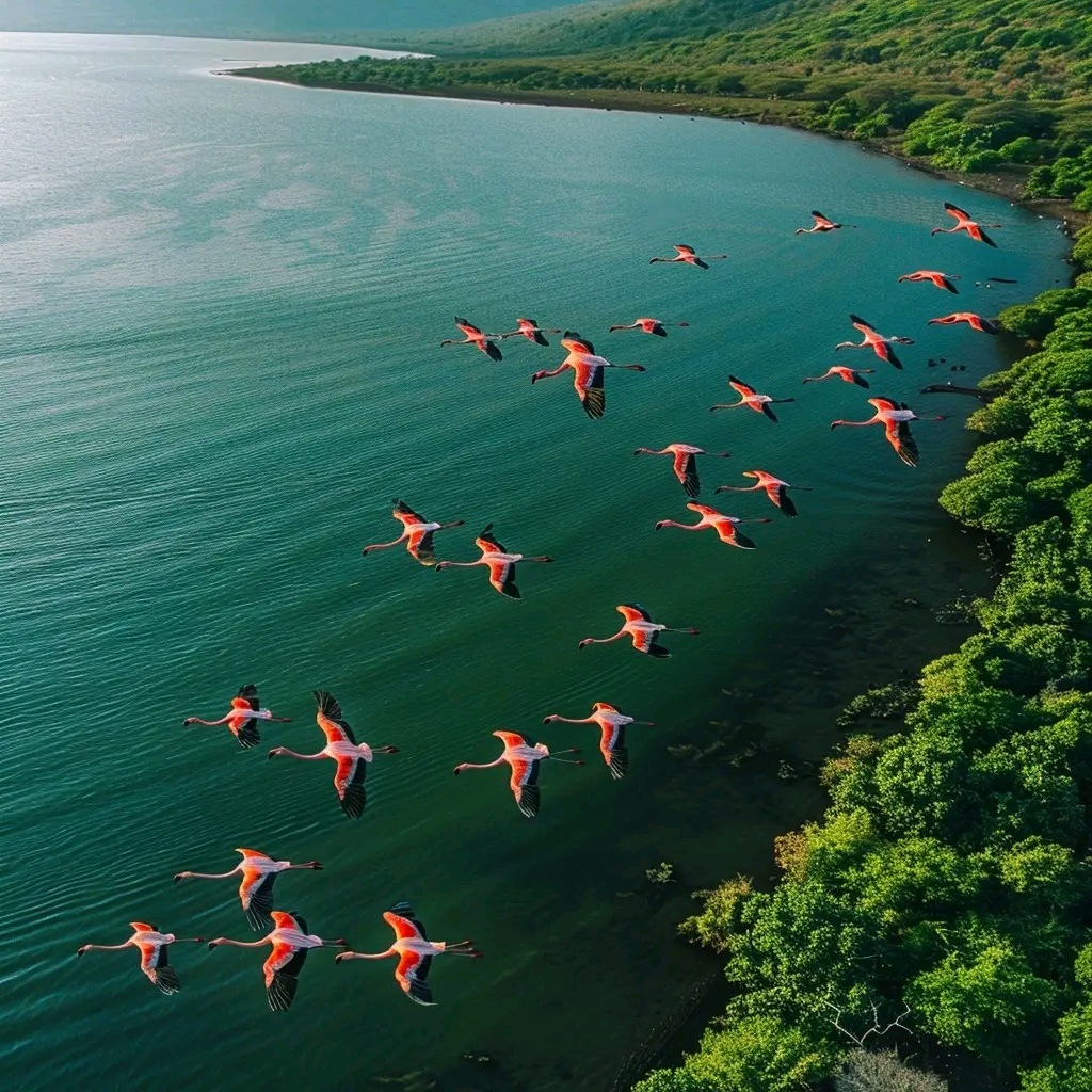
But not only mammals live in the reserve. At Lake Magadi, a predominantly alkaline lake, numerous lesser flamingos can be seen. Other common birds include ostriches, Kori bustards, crowned cranes, white-backed vultures, black kites, cattle egrets, forest eagles, Augur buzzards and many more.
A walk along the Ngorongoro Crater rim accompanied by an armed ranger takes visitors along a cattle-made path past moss-covered trees and Masai bomas, offering breathtaking views of the crater below.
The Ngorongoro Conservation Area covers vast areas of highland plains, savannahs, savannah forests and woodlands. It was established in 1959 as a mixed-land-use area where wildlife coexists with semi-nomadic Maasai pastoralists who traditionally graze livestock, and includes the spectacular Ngorongoro Crater, the largest caldera in the world. The area is of global importance for biodiversity conservation as it is home to globally threatened species and the annual migration of wildebeest, zebra, gazelles and other animals to the northern plains. Extensive archaeological research has also provided a long line of evidence for human evolution and human-environment dynamics, including early hominid footprints dating back 3.6 million years.
Short synthesis
The Ngorongoro Conservation Area (809 440 ha) stretches from the plains of the Serengeti National Park in the northwest to the eastern arm of the Great Rift Valley across vast highland plains, savannahs, savannah forests and woodlands. The area was established in 1959 as a mixed land use area where wildlife coexists with semi-nomadic Maasai pastoralists who traditionally graze livestock. It includes the spectacular Ngorongoro Crater, the largest caldera in the world, and the Olduvai Gorge, a 14 km long deep gorge. The area is of global importance for biodiversity conservation as it is home to globally threatened species such as the black rhino, large numbers of wildlife reside in the Ngorongoro Crater and surrounding areas throughout the year, and wildebeest, zebra, Thompson’s and Grant’s gazelles and other ungulates migrate annually to the northern plains.
The area has been the subject of extensive archaeological research for over 80 years and has yielded a long line of evidence for human evolution and human-environment dynamics, spanning a total period of nearly four million years to the early modern era. This evidence includes fossilised footprints at Laetoli associated with the evolution of human bipedalism, a range of different evolving hominin species at Olduvai Gorge, ranging from australopiths such as Zinjanthropus boisei to the Homo lineage that includes Homo habilis, Homo erectus and Homo sapiens; an early form of Homo sapiens at Lake Ndutu; and in the Ngorongoro Crater, remains documenting the development of stone technology and the transition to the use of iron. The entire landscape of the area has the potential to provide much more evidence of the emergence of anatomically modern humans, modern behaviour and human ecology.
Criterion (iv): Ngorongoro Conservation Area has an exceptionally long sequence of critically important evidence for human evolution and human-environment dynamics, spanning a total of four million years ago to the beginning of this era, including physical evidence for key benchmarks in human evolutionary development. Although the interpretation of many of the Olduvai Gorge finds is still controversial, their extent and density are remarkable. Several of the type fossils of the hominin tribe come from this site. In addition, future research in the property is likely to reveal much more evidence about the rise of anatomically modern humans, modern behaviour, and human ecology.
Criterion (vii): The stunning scenery of the Ngorongoro Crater combined with its spectacular concentration of wildlife is one of the greatest natural wonders of the planet. Spectacular wildebeest numbers (well over 1 million animals) pass through the property as part of the annual migration of wildebeest across the Serengeti ecosystem and calve in the short grass plains that straddle the Ngorongoro Conservation Area / Serengeti National Park boundary. This represents a truly magnificent natural phenomenon.
Criterion (viii): Ngorongoro Crater is the largest unbroken caldera in the world. The crater, together with the Olmoti and Empakaai craters, is part of the Eastern Rift Valley, whose volcanism dates from the late Mesozoic/early Tertiary and is famous for its geology. The property also includes Laetoli and Olduvai Gorge, which contain an important palaeontological record related to human evolution.
Criterion (ix): Variations in climate, landforms, and altitude have resulted in several overlapping ecosystems and diverse habitats, with short grass plains, upland catchment forests, savanna woodlands, montane long grass plains, and high open moorlands. The property is part of the Serengeti ecosystem, one of the last intact ecosystems in the world, which hosts large and spectacular animal migrations.
Criterion (x): Ngorongoro Conservation Area is home to a population of around 25,000 large animals, mainly ungulates, in addition to the highest density of mammalian predators in Africa including the densest known population of lions (estimated at 68 in 1987). The area is home to a number of endangered species, such as the black rhino, wild dog and golden cat, as well as 500 bird species. It also hosts one of the largest animal migrations in the world, with over 1 million wildebeest, 72,000 zebra and about 350,000 Thompson and Grant gazelles.
Integrity
The property was registered under natural criteria (vii), (viii), (ix) and (x) in 1979 and under cultural criteria (iv) in 2010. Thus, the declaration of integrity reflects the integrity for the natural values at the time of registration in 1979 and for the cultural value in 2010.
In terms of natural values, the meadows and forests of the property support very large animal populations that were largely undisturbed by agriculture at the time of registration. The extensive landscapes of the property were not affected by development or permanent agriculture at the time of registration. The integrity of the property is also reinforced by the fact that it is part of the Serengeti – Mara ecosystem. The property is adjacent to the Serengeti National Park (1,476,300 ha), which is also inscribed as a natural property on the World Heritage List. Connectivity within and between these estates and adjacent landscapes through functioning wildlife corridors is essential to protect the integrity of wildlife migrations. Hunting is prohibited in the Ngorongoro Conservation Area (NCA), but poaching is a constant threat that requires effective patrolling and enforcement capacity. Invasive species are a constant concern and require continuous monitoring and effective action when detected. Tourism pressures are also of concern, including the potential impacts of increased visitor numbers, new infrastructure, traffic, waste disposal, disturbance of wildlife and potential introduction of invasive species.
The area provides grazing land for semi-nomadic Maasai pastoralists. At the time of registration, there were an estimated 20,000 Maasai living in the area with a livestock population of about 275,000, which was considered to be within the capacity of the reserve. No permanent agriculture is officially allowed on the site. Further increases in Maasai population and livestock are likely to be within the capacity of the reserve, and increased sedentarisation, local overgrazing and agricultural use pose a threat to both the natural and cultural values of the reserve. At the time of inscription in 1979, there were no inhabitants in the Ngorongoro and Empaakai craters or in the forest.
The area includes not only the known archaeological remains, but also areas with high archaeo-anthropological potential where relevant finds could be made. However, the integrity of certain palaeoarchaeological features and the fragile landscape as a whole are to some extent threatened and thus at risk due to the lack of enforcement of protection measures related to grazing regimes and the planned access and tourism development in Laetoli and Olduvai Gorge.
Authenticity
In general, the authenticity of the fossil sites is not in question, but the context of the fossil deposits must remain undisturbed (except by natural geological processes) given the nature of the fossil sites. As the nomination dossier for most sites does not contain sufficient detailed information to delineate the extensive areas or the archaeologically sensitive areas, nor sufficient guarantees in the form of management regimes to ensure that the sites remain undisturbed and are not threatened by visitor access, construction works or grazing livestock, their authenticity is at risk.
Protection and management regulations
The main legislation protecting the area is the Ngorongoro Conservation Area Ordinance of 1959, and the area is under the administration of the Ngorongoro Conservation Area Authority (NCAA). The Department of Antiquities is responsible for the management and protection of palaeoanthropological resources within the Ngorongoro Conservation Area. A Memorandum of Understanding should be established and maintained to formalise the relationship between the two bodies.
The management of the area is governed by a general management plan. Currently, the main objectives of the management are to conserve the natural resources of the area, protect the interests of Maasai pastoralists and promote tourism. The management system and plan need to be expanded to take an integrated cultural and natural approach that combines ecosystem needs with cultural objectives, to achieve a sustainable approach to conserving the Outstanding Universal Value of the area, including management of the grasslands and archaeological resources, and to promote environmental and cultural awareness. The plan must extend the management of cultural attributes beyond social issues and the resolution of human-wildlife conflicts to the documentation, protection and management of cultural resources and the study of the archaeological potential of the wider landscape.
It is particularly important that the NCAA has the necessary capacity and expertise to ensure the effectiveness of its multiple use regime, including knowledge of pastoral use management in partnership with the Maasai community and other relevant stakeholders. In addition, the NCAA needs to ensure that its staff have knowledge of natural and cultural heritage to achieve well-designed, integrated and effective conservation strategies, including effective tourism, access and infrastructure planning.
A thorough understanding of the capacity of the area for human use and livestock grazing is required, based on the needs of the Maasai people and assessment of the impact of human population on the ecosystems and archaeology of the area. A joint strategy between the NCAA, Maasai community leaders and other stakeholders is required to ensure that the population size and level of resource use are balanced with the protection of natural and cultural features, including in relation to grazing and grassland management and the avoidance of human-wildlife conflict. The active participation of resident communities in decision-making processes is crucial, including the development of benefit-sharing mechanisms to promote a sense of ownership and responsibility for the conservation and sustainable use of the natural and cultural resources of the property.
In the long term, a comprehensive tourism strategy for the area is required that regulates both the public use of the area and how it is presented, prioritising the quality of the tourism experience over the number of visitors and tourism facilities. Vehicular access to the crater and other popular areas of the site requires clear limits to protect the quality of experience of the site and to ensure that natural and cultural features are not unduly disturbed. Development and infrastructure for tourism or management of the area that detracts from the natural and cultural features should not be permitted.
Given the important relationship between the protected area and the adjacent reserves, it is important to establish effective and continuous cooperation between the protected area, Serengeti National Park and other areas of the Serengeti Mara ecosystem to ensure connectivity for wildlife migrations and to harmonise management objectives in terms of tourism use, landscape management and sustainable development.
